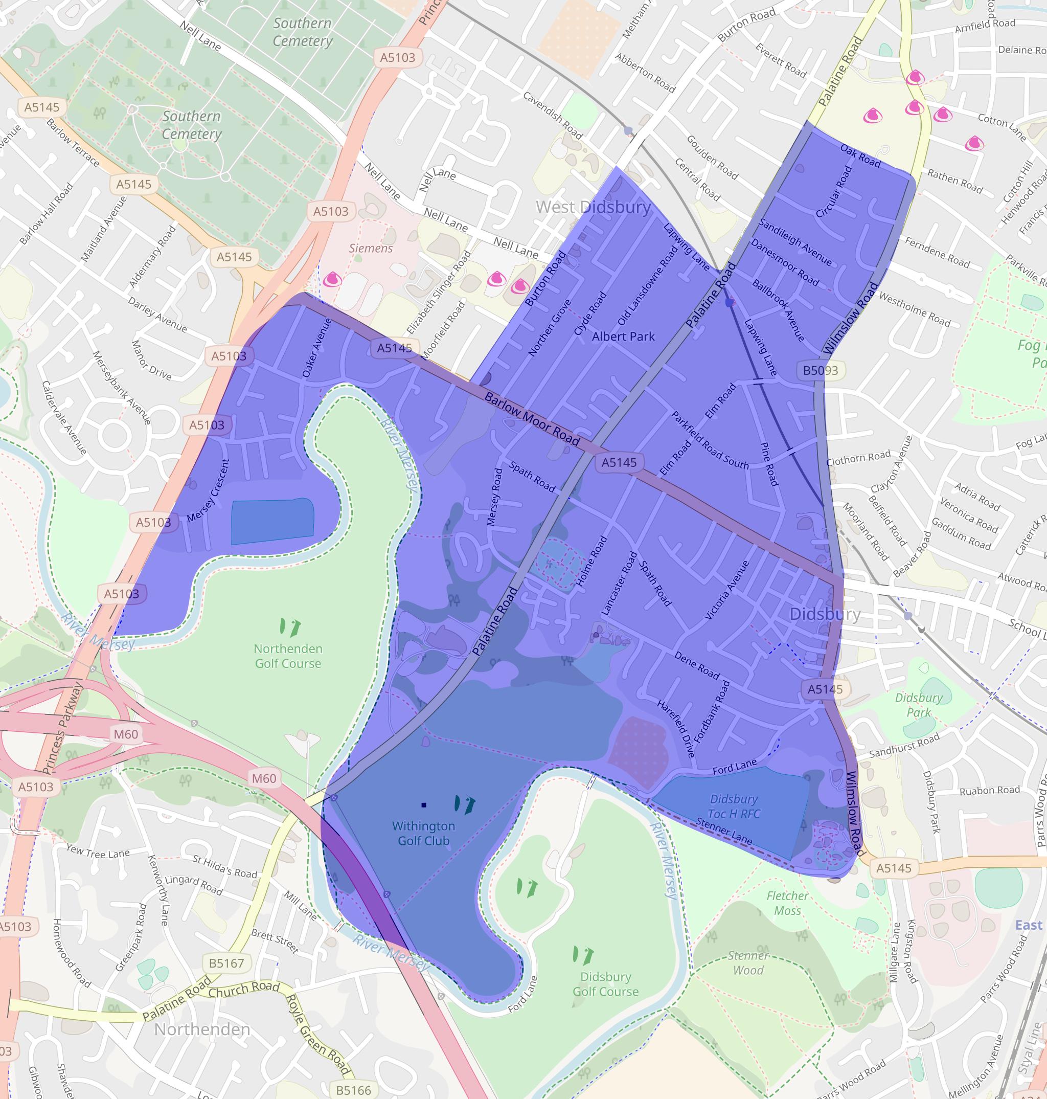
Crime statistics for the Didsbury West Policing ward
The GMP release monthly crime statistics for each ward in Manchester. The latest statistics released are for the previous month. The map below shows the Didsbury West policing ward the statistics are for. Click the map to see a larger version.
Please visit https://www.police.uk/shape/wwuRiL/ for more information, including outcomes for these crimes.
Types of crime that have increased in the last month are marked in red. Types of crime that have decreased in the last month are marked in blue.
